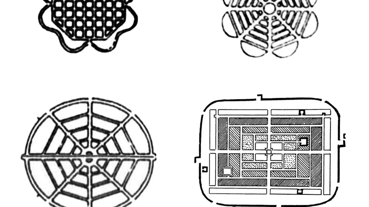
Architecture And Settlement Patterns
Origin and history
Architecture And Settlement Patterns originates as a core sub-discipline within the field of archaeology, developed primarily in Europe and North America during the mid-20th century. Its formalization coincided with the rise of processual archaeology in the 1960s, which emphasized the understanding of broader cultural systems. The approach gained significant traction through large-scale regional survey projects, such as those conducted in the Mediterranean basin and Mesoamerica, beginning in the 1970s. These projects systematically moved beyond single-site excavation to document the distribution of human occupation across landscapes. The methodology was further refined through the incorporation of technologies like aerial photography, geographic information systems (GIS), and satellite imagery in the late 20th and early 21st centuries. Its theoretical foundations are built upon earlier work in geography and anthropology concerning human-environment interaction and spatial organization.
What it is for
This archaeological approach is used to analyze the physical organization of past human communities across a landscape to understand social, economic, and political structures. Its primary purpose is to move beyond the artifacts found within a single building or ruin and reconstruct how entire communities functioned in relation to each other and their environment. Researchers employ it to identify settlement hierarchies, distinguishing between hamlets, villages, towns, and cities based on size, architectural complexity, and artifact assemblages. It is crucial for investigating trade networks, agricultural practices, and resource management by examining the location of sites relative to arable land, water sources, and routes of communication. The discipline also seeks to understand cultural norms, social stratification, and defensive strategies through the layout of buildings, streets, and communal spaces. Ultimately, it provides a framework for interpreting long-term cultural change and continuity as reflected in the built environment.
Overview
Architecture And Settlement Patterns analysis involves the systematic recording and interpretation of the placement, form, and function of structures and their arrangement within a site and across a region. A standard project begins with non-invasive regional survey to locate and map sites, followed by targeted excavation of key structures to establish chronological sequences and functional use. The material culture examined includes not only buildings but also associated features like roads, field systems, fortifications, irrigation canals, and cemeteries. Analysis focuses on the relationships between these elements, such as the proximity of elite residences to ceremonial centers or the clustering of artisan workshops in specific districts. Data is synthesized to create models of population density, land use, and community organization for a given period. The final output is an interpretation of how the spatial data reflects the society's adaptation to its environment and its internal social dynamics.
What to know
A fundamental principle is that settlement patterns are not random but are shaped by a combination of environmental constraints, technological capabilities, economic systems, and social ideologies. The classification of site types, such as isolated farmstead, nucleated village, or urban center, is a basic analytical tool with significant interpretive implications for understanding political centralization. Chronology is critical, as patterns shift over time due to factors like population growth, climate change, conflict, or trade expansion, requiring careful ceramic or radiocarbon dating. Researchers must distinguish between natural formation processes and cultural formation processes that have altered the archaeological record, such as erosion or later rebuilding. The scale of analysis drastically affects conclusions; a pattern evident at a regional scale may be invisible at a single site level. It is also essential to recognize that archaeological visibility varies, and some settlement types, like seasonal campsites with perishable structures, are notoriously difficult to detect and map comprehensively.
Common questions
How do archaeologists find undiscovered settlements without digging? They utilize systematic pedestrian survey, aerial and satellite remote sensing, geophysical prospection methods like ground-penetrating radar, and the analysis of historical documents or maps. What can the absence of certain site types in a region indicate? It may suggest environmental unsuitability, deliberate political exclusion, a nomadic lifestyle leaving minimal permanent traces, or simply that such sites have not yet been found or preserved. Why is the study of ordinary houses as important as that of palaces or temples? Domestic architecture provides direct evidence for daily life, household composition, economic activities, and social inequalities that are often less visible in monumental buildings. How do researchers determine what a building was used for? They analyze its architectural form, internal features (like hearths or storage pits), the types and distribution of artifacts found within it, and its spatial relationship to other structures. Is a dense cluster of buildings always a town or city? Not necessarily; it could represent a large village, a ceremonial center with limited permanent residence, or a palimpsest of structures from different periods that were not all contemporary.
Pros and cons
A major strength is its capacity to generate broad, regional syntheses of past human activity that single-site excavations cannot achieve, revealing networks and hierarchies. It effectively integrates environmental data, providing a holistic view of human ecology and subsistence strategies. However, the methodology often relies on surface artifacts and architectural footprints, which can lead to speculative interpretations of superstructure use and social meaning without extensive excavation. A common mistake is assuming that the largest site in a region was always the political capital, when power could have been more decentralized or vested in non-architectural forms of authority. Projects can be logistically demanding and expensive, requiring large teams and advanced technologies for surveying extensive areas. Specialists sometimes regret an over-reliance on settlement pattern data alone, as it may overlook the nuanced cultural information contained within the detailed stratigraphy and material culture of a deeply excavated key site.
Who it suits
This approach suits archaeologists and researchers interested in macro-level questions about social organization, economic systems, and human interaction with the environment over long time spans. It is ideal for scholars who enjoy fieldwork involving extensive landscape survey, cartography, and the integration of diverse data sets from geology to artifact typology. Graduate students and project directors designing regional research programs will find its methodologies essential for contextualizing their work within a broader landscape. Historians and geographers studying historical land use and urban development can effectively employ its principles to analyze period maps and documents alongside physical remains. It is less suitable for those focused exclusively on detailed art historical analysis of individual monuments, micro-scale stratigraphic excavation, or laboratory-based artifact conservation, as those are complementary but distinct specializations.
Latest Architecture And Settlement Patterns news
Latest reporting

Pathway AI Model Cuts Reasoning Costs
Researchers from AI company Pathway report their new BDH-CQ model uses a novel 'post-transformer' architecture to achieve reasoning at a fraction of...

Nile Delta Necropolis Used for Thousands of Years
Archaeologists have discovered a necropolis in the eastern Nile Delta, containing burials dating from the Predynastic period through the Greco-Roman...